What is a Land Survey & How Much Does It Cost?
By: ROS Team
People may think getting a new land survey is expensive, and, as a result, they skip this important step when purchasing new real estate. Not getting a land survey could be a costly decision, especially should you encounter problems with the property in the future. Here is a guide that will help you understand the different types of land surveys and how much a land survey costs.
1- What is a Land Survey
2- Why Do You Need
3- Different Factors Affect the Cost
4- Cost of Land Survey
5- Basic Land Survey Terms
6- Types of Land Surveys
7- How to Hire
8- Qualifications of a Land Surveyor
9- Frequently Asked Questions
What is a Land Survey?
A land survey is a process of measuring and mapping the features of a piece of land. This includes measuring the distances between different points, determining the elevations of different points, and plotting all of this information on a map. A land survey is necessary to determine the boundaries of a piece of land, as well as its features.
A land survey will tell you:
- Whether or not the legal description is accurate;
- The boundary lines of the property;
- If there has been any unrecorded or undocumented encroachment.
Why Do You Need a Land Survey?
A land survey is important for a variety of reasons. It can help you determine the boundaries of your property, which is especially important if you are considering purchasing or selling land. A survey can also help you understand any potential hazards or issues with the property, such as wetlands or zoning restrictions.
If you are planning to build on your property, a survey is essential in order to ensure that your building will be constructed in the correct location.

Factors Affecting Cost of Land Survey
Factors that affect the cost of a land survey are:
- The size of the property
- The type of survey required
- The complexity of the survey
The larger the property, the more expensive the survey will be. A boundary survey is less expensive than a topographic survey, and a simple survey is less expensive than a complex one.
How Much Does It Cost To Get A Land Survey?
Did you plan to bypass a land survey because you didn’t know how much it would cost? Well, land survey costs differ based on the size of the property and the type of survey needed. Land survey costs may also vary depending on the professional surveyor’s travel time.
On average, a basic land survey costs anywhere between $200 and $700, with the average being $500. The cost will increase as the amount of acreage to survey grows.
Of all the survey types, ALTA surveys are more expensive because they require additional work to provide more details and supporting documents. The average cost of getting an ALTA survey ranges between $2,000 and $3,500, no matter where you live in the U.S. You can negotiate who will pay the survey cost, but the buyer usually covers the expense.
Basic Land Survey Terms
- Acre: A unit of measure for land equal to 43,560 square feet.
- Boundary: The line that marks the limits of a parcel of land.
- Contour: The line on a map that represents the elevation of the land at any given point.
- Elevation: The height of a point on the earth’s surface relative to sea level.
- Parcel: Another way to refer to land
- Legal Description: This is the unique property identifier that’s included on a land survey and deed.
- Improvement: Any structural development or segment of land that adds value to the property.
- Easement: A person’s right to enter or use another person’s property without possessing it.
- Setback: The minimum distance that a building must be away from a street or road, flood plain, body of water, or any other place which is deemed to need protection.
- Encroachment: A violation of another’s property rights by extending a structure onto it.
When Do You Need A Land Survey?
A land survey is typically required when you are looking to make changes or additions to your property that may conflict with your neighbors.
For example, if you want to add an addition to your house that extends beyond the property line, you will need to have a survey conducted in order to ensure that there is no conflict with your neighbors.
If you are unsure whether or not a land survey is necessary for your specific situation, it is best to speak with a qualified land surveyor.
Types of Land Surveys
There are many types of land surveys, but each one serves a specific purpose. Before you can buy or sell a piece of property, for example, you need to have a survey done so that everyone is on the same page about the boundaries and features of the land. Here’s a look at some of the most common types of land surveys.
1) Location Survey
This survey shows property boundaries and also highlights site improvements. Investors use location surveys to request zoning permits.
Cost Location Survey
On average, Location surveys will cost you between $200 and $700.
2) Subdivision Survey
A subdivision survey is a survey of the boundaries of a parcel of land subdivided into two or more lots.
Cost of Subdivision Survey
The cost of a survey will vary depending on the size and complexity of the subdivision but can range from a few hundred dollars to several thousand dollars.
3) ALTA Survey
American Land Title Association (ALTA) survey is a type of land survey that is ordered by a title company or lender when they are issuing a mortgage on a property. The survey is used to ensure that the property is accurately described and that there are no liens or other issues with the title that could prevent the sale from going through.
Cost of ALTA Survey
ALTA surveys typically cost between $2000 and $3000.
4) Boundary Survey
A boundary survey is a survey that is used to determine the legal boundaries of a parcel of land. The boundaries are determined by reviewing the deeds, surveys, and other historical data for the property. The surveyor will then mark the boundaries on the ground with flags, paint, or some other marker.
Cost of Boundary Survey
Expect to pay something between $150 and $700 for a Boundary Survey.
5) Topographic Survey
A topographic survey is a process of mapping out the features of a particular area, including its elevations, by taking measurements of the area’s terrain. This information is used to create a detailed map that can be used for planning and development purposes.
Cost of Topographic Survey
A topographic surveyor will charge more for a larger lot. The average cost for a topographic survey of a lot that is 10,000 square feet or larger is $1,200 to $2,500.
6) Construction Survey
A construction survey is a type of survey that is carried out in order to gather information about the construction of a building or other structure. This type of survey can be used to ensure that the construction is proceeding as planned and to identify any potential problems or issues that may need to be addressed.
Cost of Construction Survey
If you are interested in getting a construction survey, be prepared to pay anything between $1,000 and $2,000.
7) Site Planning Survey
This type of land survey is used for site improvements. Investors request site-planning surveys when they apply for building permits.
Cost of Site Planning Survey
The cost of a site-planning survey varies depending on the size and scope of the project. Generally, the cost ranges from $1,000 to $10,000.
How to Hire The Right Land Surveyor?
When hiring a land surveyor, it is important to ensure that they are qualified and experienced in the field. The best way to do this is to ask for referrals from friends or family members who have used a land surveyor in the past. You can also check with your state’s licensing board to see if the surveyor is licensed and insured.
Once you have a few names, set up appointments to meet with each of them. During the meeting, ask questions about their experience, what type of surveys they specialize in, and how long they have been practicing. It is also important to get a sense of their personality and whether you feel comfortable working with them.
Once you have selected a surveyor, be sure to outline the scope of the project and what you expect from them. This will help avoid any misunderstandings down the road.

Qualifications Of A Land Surveyor
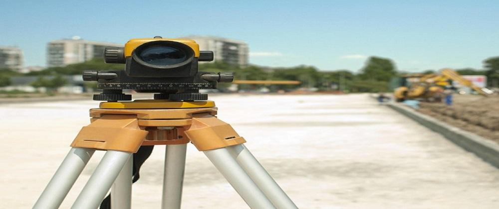
A land surveyor is a professional who measures and maps features of the earth’s surface. They use specialized equipment to collect data that is used to create legal documents and maps.
Each state has different land surveyor licensing requirements, so you will need to contact your state board of registration for surveyors to find out what is required. Generally, you will need to have a degree in surveying or a related field, complete an apprenticeship or training program, and pass an examination.
Is It Worth Getting A Land Survey?
There is no definitive answer, as the cost and usefulness of a land survey can vary greatly depending on the specific situation. However, in general, a survey can be a very useful tool for understanding the features and condition of a property – especially if there are any potential issues that need to be addressed.
FAQs
How to Get a Copy of a Recorded Land Survey?
You can get a certified copy of a land survey from the official records at the land recorder’s office or the building department’s office. In some states, you can get a copy of the recorded land survey from the local tax assessor’s office. Another source for getting it is a title company. Typically, title companies also ask for an ALTA survey before doing title insurance. So, you are likely to find a copy of that from them.
How Long Is A Land Survey Good For?
Land surveys are typically good for a 10 year period.
Should I Add Land Survey Contingency in the Purchase Agreement?
Besides learning why a land survey is important and what is generally covered in the survey. You should also consider adding a land survey contingency to your contract. You may notice that it’s required in most purchasing agreements. It’s the only way to ensure that you are getting what you paid for entirely.
A survey contingency in a contract will force the seller to address any problems a survey reveals before the transaction is finalized. Or, if the seller chooses not to address the issues, you have grounds to walk away from the deal without facing any financial penalties.
How Much Is A Land Survey in NYC?
Generally, you can expect a land survey in New York City to cost under $1,000.
Who Pays For A Land Survey?
If the buyer wants the survey, they will typically need to pay for it. However, some sellers may be willing to cover the costs of the survey if it means that the sale will go through. Ultimately, it is up to the buyer and seller to negotiate who will pay for the survey.
Can You Perform Your Own Land Survey?
Yes, you can perform your own land survey as long as you are accurate. A mistake could mean a costly lawsuit, though, so be vigilant in your measurements.
Read Also:
How Much is an Acre
Step by Step Guide for Buying Land with Cash
Do You Want to Buy Land With Joint Property Ownership?


